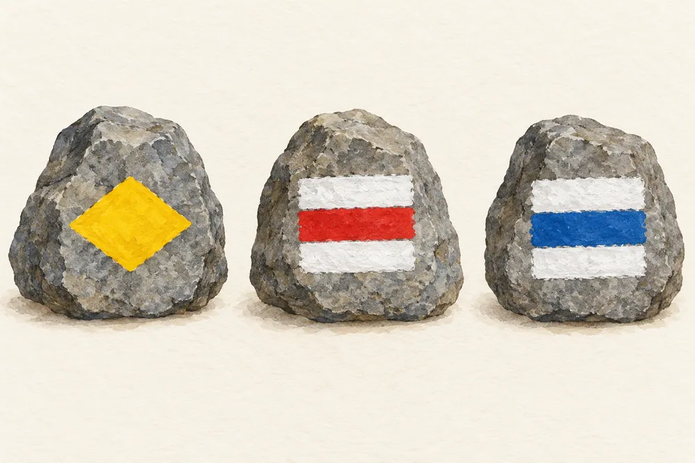
In Switzerland, yellow marks identify hiking trails, white-red-white marks identify mountain hiking trails, and white-blue-white marks identify alpine hiking trails. Each category describes the terrain and the walking skills it requires. Swiss Hiking
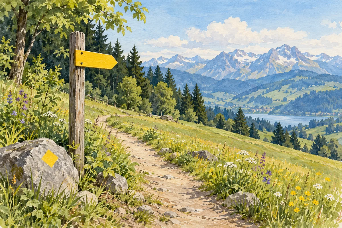
Check the arrow’s tip as well as its background. Mountain-trail signposts are also yellow, with a white-red-white tip. Alpine signposts are blue with a white-blue-white tip. Swiss Hiking’s signposting background
Match the mark to the terrain
Yellow hiking trails often follow broad paths, but they can also be narrow or uneven. Swiss Hiking describes steps on steep sections and railings where there is a falling risk. They still require ordinary care and attention. Trail categories
White-red-white mountain trails are often steep and narrow, with some exposed sections where a fall could have serious consequences. Walkers need steady footing, comfort with heights and good fitness, together with an understanding of mountain hazards such as rockfall and sudden weather changes. Trail categories
White-blue-white alpine trails can cross snowfields, glaciers or loose rock and include short climbing sections. Some stretches have no path. Protective installations cannot be assumed. These routes require strong mountain skills as well as fitness. Trail categories
Read the rest of the sign
The location panel gives your position and height above sea level. When several destinations lie in the same direction, the nearest appears at the top. A horizontal dividing line indicates that the routes branch farther ahead, so two places sharing an arrow need not remain on the same path. Reading a signpost
Green labels with a route number or name identify named hiking itineraries. Between signposts, diamonds or painted marks on rocks and trees confirm the way. Keep reading the category marks as you follow your chosen destination. Reading a signpost
Plan the walk behind the arrow
The time on a sign is an average walking time with breaks excluded. Swiss Hiking explains that its calculation accounts for length and gradient, but not the walking surface or your fitness. Add time for rests and adjust your plan to your own pace. Walking-time guidance
Before setting off, compare the route’s distance, height gain and difficulty with the abilities of everyone walking. Check the forecast, current route conditions and possible alternatives. A marker describes a trail category. It cannot report today’s conditions or establish whether a route suits your group. Planning guidance
Winter hiking and snowshoe routes use pink signposting. They have their own seasonal requirements, so use the information for the winter route you intend to follow. Swiss Hiking’s signposting background